Showing posts with label lighthouse. Show all posts

Wednesday, June 28, 2023

Snapshots of Prince Edward Island

The eight mile long Confederation Bridge was opened in 1997.  The idea of a bridge was heatedly debated before a referendum passed by 59.4%.  It transformed life on the island and eventually gained widespread approval.  We arrived at the bridge on a windy, rainy morning.  New visitors frequently stop at the viewpoint on Cape Jourimain as these young people did.  The ride across the bridge is smooth, but we'd have liked to have had a clearer view.


Once on the island, one soon sees hallmarks of this small province with only about 150,000 residents.  The sea is always nearby, so a great variety of lighthouses are seen.   This is Cape Bear Lighthouse where the first radio message was received from the stricken Titanic.

Largely, the lighthouses are wooden.  The island lacks hard stone that is so often used elsewhere.

Two more constants are flowering lupines and small fishing harbors.  The lupines are widespread.


There is abundant seafood to feast upon.  This lunch featured a fresh haddock sandwich and bay scallop tacos, both with PEI potato salad and cabbage slaw.  You can't drive more than 5 kilometers without passing a field of potatoes. 

Another certainty is friendly people.  Pam and I agree that the residents are another hallmark.

Our first three days were marked by cloudy and breezy days - not ideal for photography but fine to explore.  On several occasions, we visited locations marked by seaside tragedies.  This is Covehead Lighthouse.

 
The Yankee Gale of  October 3, 1851 claimed 74 ships and 150 lives.  The fishing fleet was calmed in the evening and unable to return to harbor.  In the night, the gale drove the fleet onshore with no mercy.
 
For most of our days on PEI, I searched for that perfect display of lupines.  There was this small bouquet framing a grave marker next to a rural church.  Not many are colored pink so I liked these.

My luck changed when we visited an abandoned shipyard at Murray Head across the bay from Georgetown.  Wow, three lupine colors in one place.
 
While researching places to visit, I discovered a number of "Pioneer Cemetery" listings.   There was one near Cavendish called "Yankee Hill Pioneer Cemetery".  It also had a lighthouse nearby.  Walking in on the private road, we were greeted by the owner who was in the process of clearing the trail to the side.   Bruce highlighted the history and paused mowing while we explored.


These are the stones for Mary Pickering (1792-1878) and Thomas Pickering (1790-1878).  They had eleven children.  He was a farmer, mariner and shipbuilder. 

Another was a marker for George McKay, a native of Durness, Scotland.  (1763-1816)

Bruce is building a home on Yankee Hill with a ocean view that includes a view of this lighthouse on London Bay.

It may seem unusual to include cemeteries in an itinerary, but in Atlantic Canada, they are  a continuing link to people's pasts. We stopped at the Brackley Beach Cemetery on the north shore where two ladies were unloading trays of flowers for placing on markers of family members.   In Cavendish Cemetery, this marker honoring mariners lost in earlier mentioned Yankee Gail of 1851.  At a cemetery in Georgetown, this marker remembers a boy lost at age four.  Note the childhood ornaments for those who died young.  I've seen this elsewhere.

At our last hotel in Montague, I woke for the very early sunrise.  The highway bridge was lined with planters full of petunias.

The sunrise was framed with three large cast sculptures of cormorants.


It was now time to head home.  Again, we stopped at the Confederation Bridge for one last look.


We paid our $50.25 toll and returned home..

One last comment is for golfers.  The island has many lush courses that could be imagined to be in Scotland- rolling hills, sandy bunkers and picture perfect greens.  We met several people touring across the island for a new course each day. Sadly, I was terrible at golf.

Paul Schmitt

Tuesday, February 21, 2023

It's a Maine Thing

The Mid-Coast of Maine is a favorite place for me.  I've been long overdue to return, and last week I finally took five days there. In winter, it is far quieter - so much so that it can be difficult to find restaurants staying open.  I was one of eight photographers in a program offered by Hunt's Photo in Boston.

I arrived a day early for a more leisurely pace.  After a 5 hour drive, my stop was just over the border at Kittery.  Before dinner, I went over to the Nubble Lighthouse.  The wind was "brisk", but it did not discourage locals from enjoying the sunny day. I shot about 40 images to freeze the wave in the foreground.

Up early,  I hurried north to the iconic Portland Head Light.  It you look closely at the light keeper's building closer to the base of the tower, you can see three orange rectangles.  Those are where huge January waves  crested over the rocks and broke out windows. 


The waves were far more modest during my visit.

With all of us in our lodging in Wiscasset and introductions made, we visited South Bristol Harbor.  It is a small working harbor with little tourist activity. Central to the village is Osier's, which is a grocery,  food takeout, lobster pound and roadside gas pump. 


There is a lot to discover.  Buoys draped in a dead tree branch.

On the dock behind Osier's I found piles of fishing gear.


I can't tell you what this net is used for, but the form was attractive, so I had to share it.


The next day we had some dreary weather, so we explored some local museums.  There were some interesting discoveries.  Ropes in a shipbuilder's shop.

Antique car grills at Owls Head.


The next morning was cold but favorable at Pemaquid Point.  This is my favorite lighthouse of all.  Down here you can grasp the height of the promontory it occupies.  The sloping layers of rocks rise from the waves dramatically.  (The tide was rising, and shortly after this I had to retreat upward. )


Up at the lighthouse, there are, even on a cold and icy morning, some hearty people coming out for the view.


Every visit I have ever made to Pemaquid has been inspiring. Soon afterwards, we were at Deb's cafe for hot coffee and great food. It was worth departing at 5:15 am to be there for another beautiful dawn.

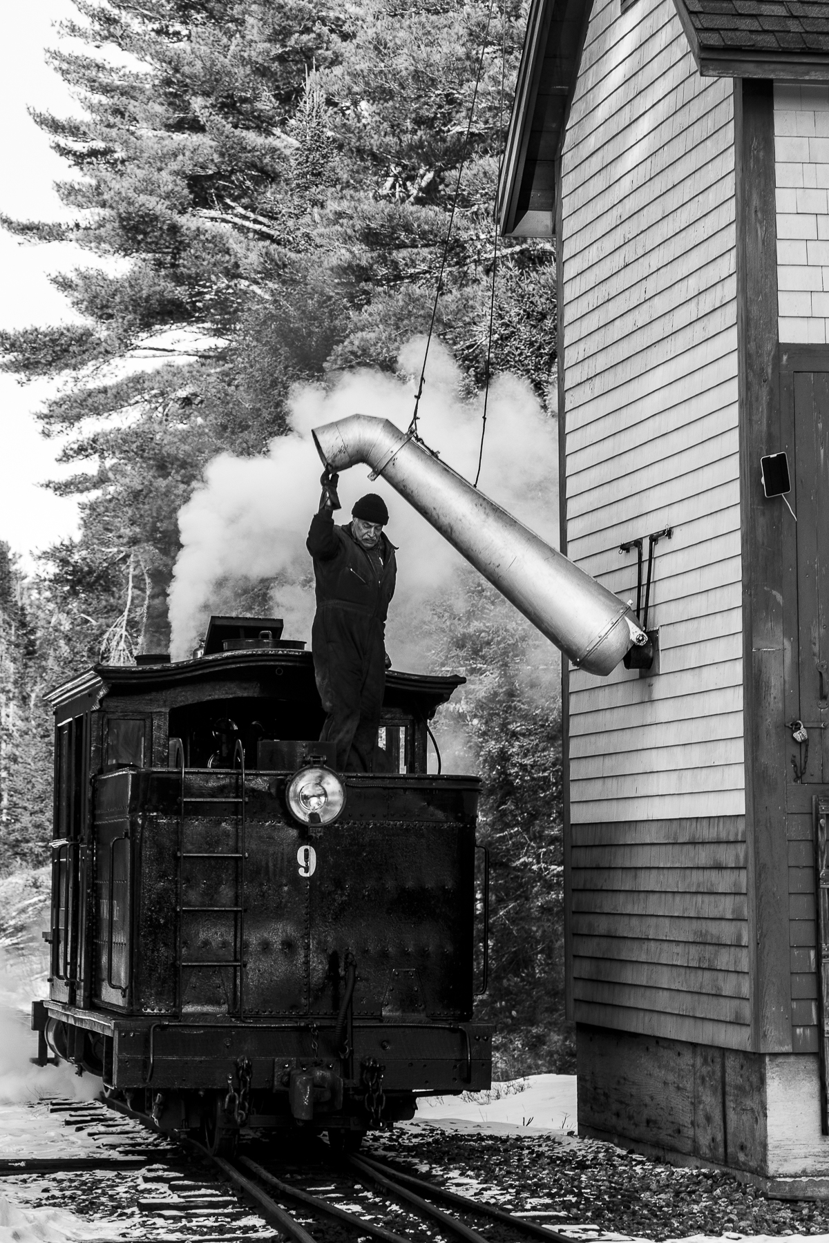
That afternoon, we made a big shift in subjects to a small narrow gauge railway near Wiscasset, the Wiscasset, Waterville & Farmington.  It's totally volunteer based and very busy even in February. Here are a few images:


Our final morning was at Friendship Harbor. Again, this is a working harbor with little tourist flavor.  It was another early start.

There was a very creative Christmas tree still on the one dock in mid-February. 

The sunrise cast a golden glow on one of the fish houses.

Nearby was another fish house with buoys that seemed best in monochrome to reflect on time.

Maine in winter is clearly not dreary, nor boring.  Just a little patience is called for when weather is in control.  Natives seem to thrive in winter. 

Well, this ran into more images than is my usual.  Hopefully it is sufficiently entertaining.

Paul Schmitt

Wednesday, July 25, 2018

Part Two- the Oregon Coast

Part Two of our May adventure began when we arrived at Fort Stevens near the mouth of the Columbia River.  I will say more about our beautiful camping van later, but it was completely fitted for two travelers- queen bed, stove, oven, bathroom, fridge and generator. It was easy to drive. Once in our camping space, we immediately went to the beach to see the famous wreck of the Peter Iredale.  It was a sunny day and crowded.  Pam got this nice photo while I struggled on the opposite side with a ton of people - some digging in the sand, etc.

We saw a fog bank building to the south and rolling towards us. Within fifteen minutes, it captured the beach, and beach goers began heading to their cars as the air cooled. I had a completely different view of the Peter Iredale.  Pam sure got the better image.

The next morning, we were awake early and eagerly heading south to our first stop at Ecola State Park for the classic view of the seastacks at Cannon Beach.

The beaches in Oregon are public property, and access is frequently offered.

Our next stop was on the opposite side of the sea stacks seen above. Easy parking was offered, and we explored the beach looking toward Ecola.  This young lady was exercising her two dogs by throwing a rubber toy into the surf.  They would retrieve it, and tease her until they wanted her to throw it again.

We continued south with stops to see additional ocean views. At Yaquina Bay, the state park offered a view of the iconic bridge over the river.


The park at Yaquina also had a lighthouse marking the entrance to the bay and easy parking for our beautiful Mercedes van.


It had two captains seats in front. A slide out for the bed was located behind the driver's seat. Behind the slide out were storage cabinets on the driver side and a kitchen on the passenger side. To the rear were shower, toilet and wash basin.  The Mercedes was powered by a husky diesel that handled the mountains smoothly.  The vehicle width was a normal van width, which made it easy maneuver.  We loved it.

One of the highlights of the coast was the Devil's Churn at Cape Perpetua.  At high tide, ocean swells roll in to a narrow fissure in the lava rocks that resemble a funnel.  The waves dance and swirl in patterns that are never repeated.


Continuing south, the coastal highway tracks inland before returning to Sunset Bay. As we left our camp we paused at an ocean view that was best presented in monochromatic tones.  Our time there was  limited, but I have to project what this would be with a good storm rolling swells onto the shore.


On May 16, the rhododendrons were reaching peak bloom, and our good fortune was to arrive at nearby Shore Acres State Park to enjoy a wonderful formal garden rich in colors. This is the gardener's cottage.


We found explosions of color.


 There were intimate settings with subtle rhody colors ....


and this garden pavilion, that surely was the scene of many social events.

We reluctantly left Shore Acres and continued on our southerly journey.  Nearby we found the Coquiles River Lighthouse.  Wish the lighting had been better.


Our adventure continued as we followed Seven Devil's Road to find the Face Rock Overlook.  Did not recognize any "face" in the sea stacks, but no matter. The beach surely provides a nice stroll. 


Oregon seems to have a fascination with "Devil". They have Devil's Churn, Devil's Washtub, Devil's Elbow, Seven Devils Road and maybe more.  Our own interest was wider, to include the rugged coast, lighthouses, sea stacks and abundant flora.  Shore Acres was arguably the high point of it all.

On the next leg of our trip we worked in coastal Redwoods and Crater Lake.

Paul  Schmitt

Friday, August 25, 2017

Along the Way to Newfoundland

Our summer of travel concluded with a road trip to Newfoundland with the usual stop in Freeport for the LL Bean store, plus a few discoveries along the way. On day two we were near Lubec at the border with New Brunswick.  Rising early, I watched the sun rise over Campobello Island across the Lubec Narrows. As the sun rose directly behind the Mulholland Point Light, a lobster boat motored past on the way to run their traps.  Serendipity.  This is now on my list for a longer explore including Campobello.


Our drive north took us to Hopewell Rocks on Fundy Bay.  The huge tides there cycle up and down on tall pillars of aggregate.  We'd been there decades ago with good memories.


It seemed much more crowded now  and  more like an amusement park. It was less enjoyable this time.  I guess the first time was enough.  We moved on to our appointment with the ferry to Newfoundland.

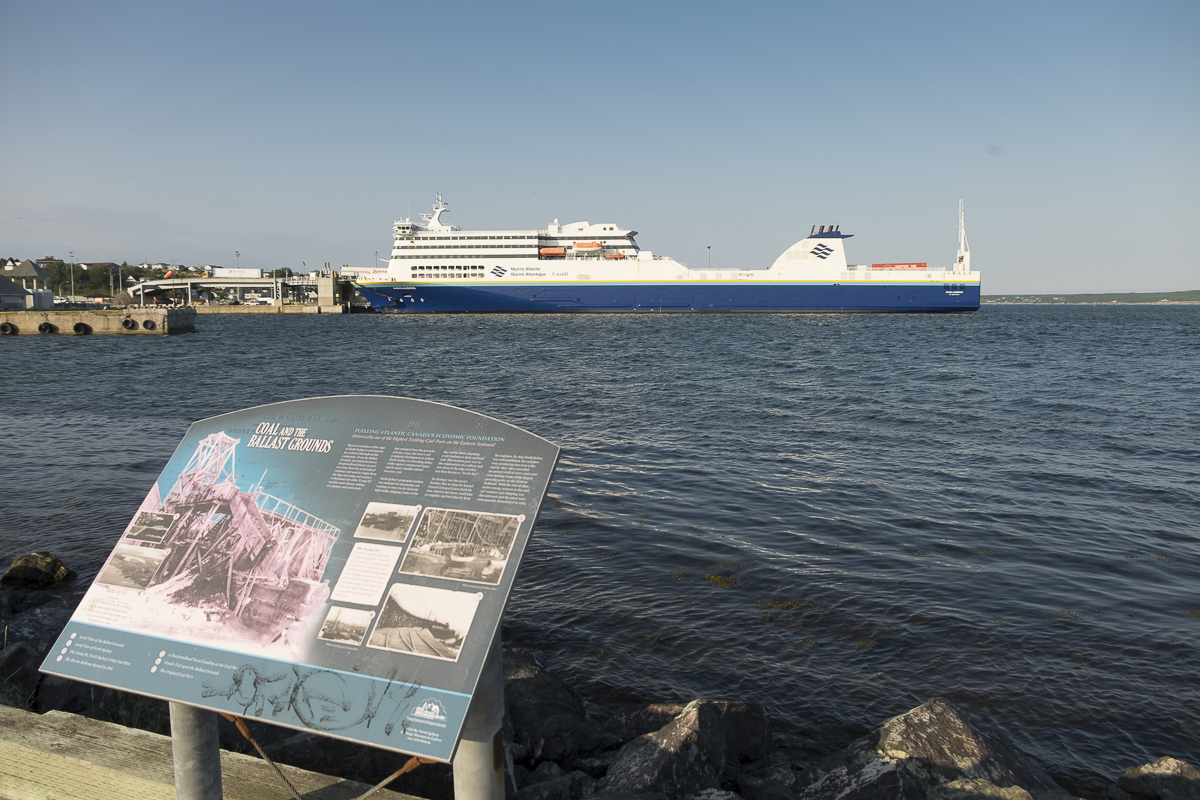
Arriving in North Sydney, the sight of the MV Highlanders is impressive.  At 200 meters, it is the largest ferry I have seen.  It has eight decks including four for vehicles.  It can load and unload from both bow and stern at two different levels. We made the mistake of being early, which put us on board first and thus in the lowest level - which I dubbed "the catacombs". It was pretty tight down there.


But I make no complaints.  The accommodations were superb. Our cabin overlooked the bow directly below the ship's bridge where we could watch the loading process.  After a restful night with calm seas, we were in Port aux Basques and ashore in time for a nice breakfast in town.

Our first of two objectives was Gros Morne National Park.  To understand why we went there, see this link:  https://www.tourgrosmorne.com/ 

Up early on our first full day, I explored a lighthouse at Lobster Cove just outside Rocky Harbor.


The lighthouse grounds were well restored, giving a feel for their history.  Coming over the rise from the beach, one found the route to the light keeper's garden.


The day continued with an early start towards Western Brook Pond. This is a stranded fjord.  Once open to the sea when oceans were higher, its mile wide glacial moraine now seals it off from the sea.  There are excursion boats hauled there on sleds over the moraine in deep winter.  With no road, we had a 3/4 hour walk to get to the docks.  Along the way, I found this odd fellow hanging out at a viewing platform.  He seems to be everywhere I go.


As you trek to the pond, the massive walls of the fjord reveal themselves across one of the many shallow ponds on the moraine. 


Once at the boat, and looking upwards, the fjord gains its true character.  There are massive hard rock walls on both sides.  (Here is a great photo that Pam made of the place.)


Along the way, the rock walls offer an infinite range of features, some capturing our tendency to see figures in the stone.  Can you see the man's face in this wall?  (Left of center looking right.)


There are more curiosities to be found at Gros Morne.  Just north of Western Brook Pond are some sea arches that seem out of place being surrounded by glacial moraines.


There is another side to Gros Morne. Across Bonnie Bay to the south of our cabin in Rocky Harbor, lie small fishing villages and the expansive Tablelands.  At Woody Point, I found one of the small lights guiding boats into the bay's west arm.


These are active fishing towns.  We ventured to Trout River where the stacks of wooden lobster traps reminded me that some still do things the traditional way.


No visit to Gros Morne is complete without a visit to the Tablelands.  Several hundred million years ago, a tectonic plate collision forced up material from the earth's mantle. As you enter the elevated valley, you see hard rock to one side and crumbly yellowish-red rock to the other. This softer rock, called mafic rock is peridotite thrust up from the earth's mantle. It is low in calcium but high in magnesium and iron with a toxic mix of heavy metals.

The plant community is drastically different.  We walked a small loop and found hundreds of Pitcher Plants. They love alkaline conditions and thrived wherever there was a water.


Along this little-used trail were unusual rocks. The rock appeared to be glazed with a blue-black lacquer. It is serpentinite, so called because it resembles snake skin.  Get this, it is a hydration and metamorphic transformation of ultramafic (mantle) rock.  Beautiful.

We spent three full days at Gros Morne and could have explored more, but we had a full day's travel to relocate to Cape St. Mary's for some serious birding time.   I will be back with a second part devoted to that.

Paul