Before this trip, I only met one person who did not say something like "Why would you go there?" I understand the name and its having recorded 134 °F on a particular July day in 1913. Hey, that was a long time ago! Anyway, I went in late February for temps between 33 to 60 °F. Stick with me, and you may be convinced to put it on your travel list.

Arriving by air in Las Vegas, I ran a gauntlet of slot machines right at the disembarking gates. Actually, I think they are there to grab the last dollars from departing visitors. My time in Vegas was only as long as it took to claim my rental SUV, and begin the two hour drive to Furnace Creek. It was an easy road with only one town of any size along its length. I even saw light ephemeral snow as I cleared Mountain Springs Pass. I was looking forward to a three-day program offered by Canon, featuring the professional photographer, Erin Babnik. She was inspirational.

Furnace Creek is an oasis near the Badwater Basin. It has a park visitor center, campgrounds, lodging in both the upscale Furnace Creek Inn and the adequate Furnace Creek Ranch, and a sparse general store. The visitor center was well- staffed and offered excellent guidance in selecting an itinerary suitable for one's interest and abilities.
Death Valley is a large national park with few of the services we take for granted. Topmost among those is a gasoline pump. Prepare yourself for sticker shock. It was $4.24/gallon at Furnace Creek, compared to $2.63/gal at Beatty outside the park. Ouch! The concessionaire has you with no alternatives.
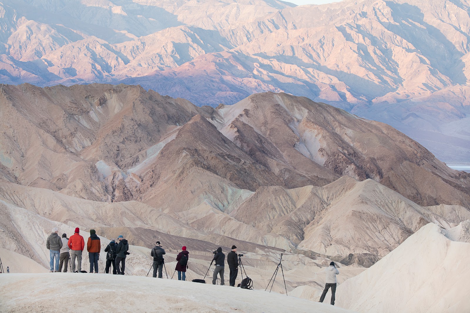
The iconic view for a first time visit is Zabriskie Point just outside Furnace Creek on the road to Vegas. Be there well before sunrise to catch the soft, warm light on Manly Beacon seen in the right foreground. The best morning has some broken clouds to the east to prolong the good light.
You will not be alone either at the paved overlook, nor on the lower viewpoint seen below. There is another option requiring an earlier start. The trail to Golden Canyon from Zabriskie Point offers some lower view points that place Manly Beacon higher, relative to the distant blue sky. (That is on my list should I be fortunate to return another year.)
The beautiful textures and colors are one notable aspect of Death Valley to me. Looking ninety degrees away from Manly Beacon, the park offers some rich features. As I explored one area, the ravines suggested a sweet confection that blended dark, milk and white chocolates.
Off a little more to the left it suggested some other sort of a dessert. Perhaps I suffered from too little breakfast at 5:00 am that day?
On the first afternoon, I went to Mesquite Flat Sand Dunes which is about ten miles north of Furnace Creek. Getting to the east side of the sand dunes calls for a mile hike, beginning on crusty alkali flats and ending on shifting mounds of sand. It is an arduous hike, seeming to require one and a half miles of effort to return to the highway. The view of the dunes was worth the effort..
An hour before sunset, the nearby dunes already captured beautiful shadows that defined the wind swept features. I believe I could return here over many years and always find something inspiring.
As the sun dropped behind the distant Panamint Mountains, the highest dunes took on a form reminding me of some silky cloth.
As you can surmise, most of the great images are offered early and late in the day. The next morning began at the Badwater Basin which is the lowest point in North America. It is 282 feet below sea level. The basin stretches for miles before rising to Telescope Peak some twenty miles distant.

On rare occasions, heavy rains flood the basin and, as it slowly dries, the salty water forms into plates. This photo is special to me. Canon loaned me a $2000 tilt-shift architectural lens that had the ability to capture a focused image from 3 feet to infinity. I can only dream of owning such a lens.
Other parts of the Badwater Basin have interesting features that come from flash floods. As the wall of water exits a canyon, the entrained debris quickly settles out, beginning with the largest boulders and ending far out on the plain, where it forms a mud playa. Like the image above, it slowly dries into fascinating mud tiles. In the afternoon, we explored the many shapes offered.
Much of our third day was devoted to post-processing images, but that evening we visited what appeared to be somewhat in between salt and mud playa.
With the Canon program concluded, I chose to stay in Death Valley another day and a half. A retired park ranger offered some advice for my first free day that begin at 5:00 am driving to Beatty, Nevada. It was 51°F in Furnace Creek (elevation -190 ft.) and 33°F at Beatty (elevation 3300 ft.). Beatty offered several benefits at 6:00 am - gas for $2.63/gallon, hot coffee and a sandwich shop for my midday break. The ranger insisted I begin with a full tank. Smart.

My first stop was the abandoned mining town of Rhyolite (1904-16). I explored it close to sunrise. It was actually a rather large town, and had an electric power station and a railroad spur. But the gold played out quickly.
What is left are remnants of a boom town. A caboose and water tank remain near the fenced railroad station.
A one-room house sits alone framing the distant mine office building.
Only a few walls of the mine office have survived.
An overstuffed chair remains some hundred years after the mine closed.
I reluctantly left Rhyolite with the knowledge that my plan to drive the length of Titus Canyon Road would take 3-1/2 hours plus any time to stop for photographs. Ranger Bob have planned out a full day for me, as you will see.
The first twelve miles were over sagebrush flats on a rough road holding my Jeep Compass to about 10 mph. It steadily gained elevation up to Red Pass at around 5700 ft. By the way, the road is one way, as in single track and very unfriendly to long vehicles.
Then it got interesting. I had on my list photos of mines and geology. I found my first mine opening just before the boom town of Leadville. It's not exactly exciting, but finding one that was accessible, and not barricaded, was satisfying for me.
Leadville was the product of the Roaring 20's and did not survive very long.

A few mines are seen high up on the mountain slopes, and otherwise a few buildings remain. Someone probably lived in this ramshackle hut.
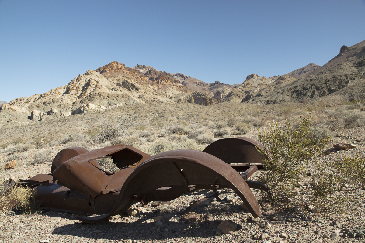
Further down the road was the remains of a car, maybe a Model A Ford?

Farther along was one of rare year-round springs in what are called the Grapevine Mountains. A few birds were there, and reportedly mountain sheep come for water every three days. It must have a long human history as revealed by petroglyphs on a huge rock wall.
From Red Pass, the road generally lost elevation save a climb over a minor pass into Leadville. Leaving the ghost town, the road entered a canyon, often becoming quite narrow.
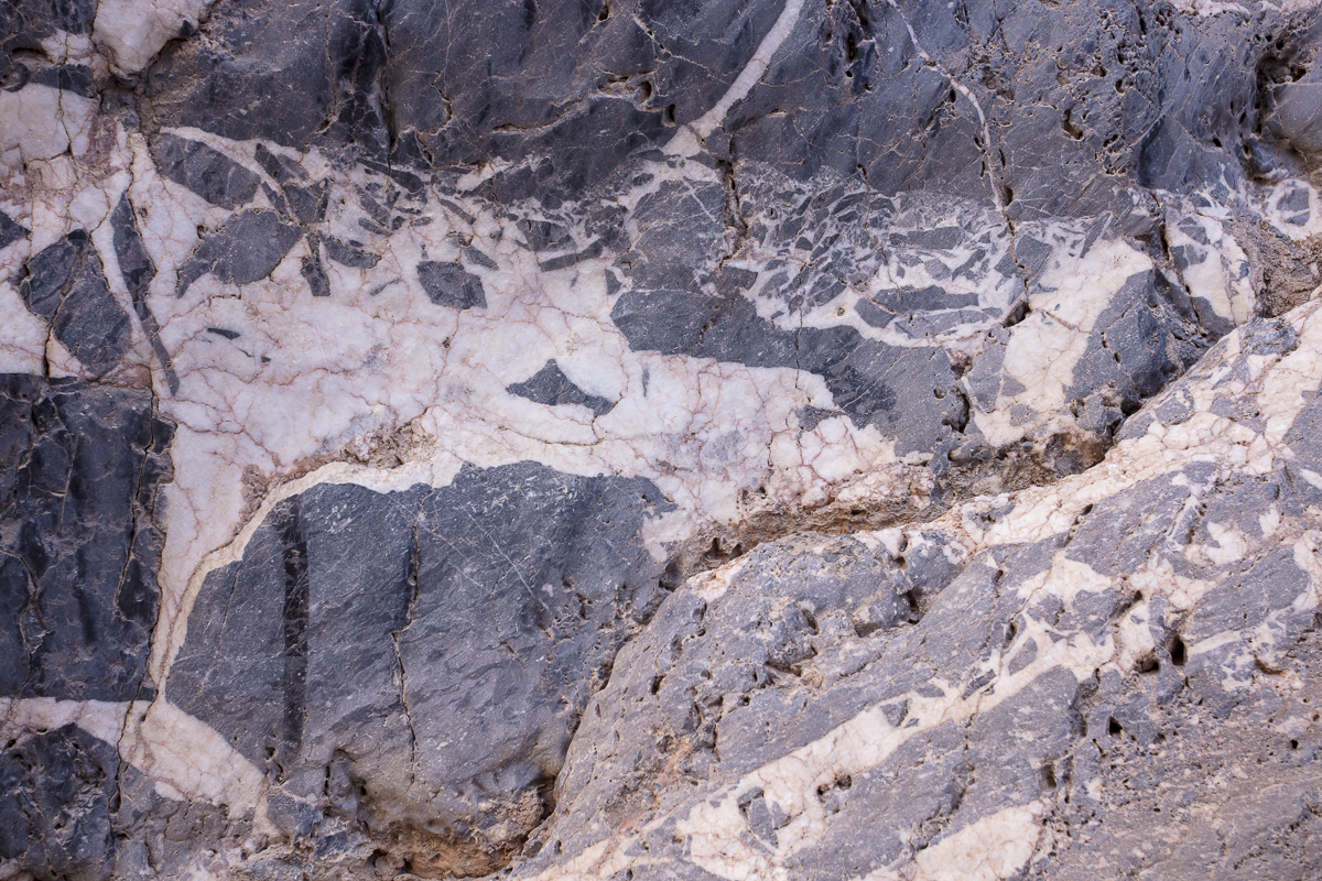
Along these canyon walls, I found patterns which suggest hard rock intruded into softer layers to create interesting patterns. It suggested to me a sperm whale with its mouth open.
I also liked this pattern.
I soon exited the canyon and had one more destination, Ubehebe Crater. About 2000 years ago, rising magma reached ground water and a massive explosion resulted, leaving an 800 feet deep crater. You can hike to the bottom on a rather steep trail of fine pebbles.
At this point in a long day, I passed on the experience offered.
Once
back in Furnace Creek, I explored the remnants of the borax mining
industry including the famous Twenty Mule Team wagons and the other
relics displayed. (Sorry, they are all out of mules now.) It appears that the dry climate - 9% in February - contributes to relics of the past not decaying.
The wheelwright's skills are remarkable as seen in the little museum at Furnace Creek.
 |
| Water barrel on borax wagon |
 |
| Brakes on borax wagon |
On my final morning, I took the time to slowly explore Twenty Mule Team Canyon just past Zabriskie Point. As I found earlier, the geology of Death Valley creates beautifully varied colors and patterns. There must been some sulfate deposits up on the top where the turquoise color is seen.
This was my last image of the trip. Surely these images explain the attraction of Death Valley. Just don't go in the summer.
Hope you enjoy the story.
Paul Schmitt